Day 1 - October 2nd, 2010
A shutt
 le picked us up and drove us to Long Beach Airport. We flew to Boston with Blue Jet Airlines and landed at Logan International Airport at 5:00 AM.
 We picked up our car from Hertz and drove to Yarmouth in Cape Cod. We were there around 8:00 and found our hotel – Pier 7 Condominiums. The sign on the door notified us that they do not open until 9:00 and we decided to tour the area.
=================================================================================================================================================================================
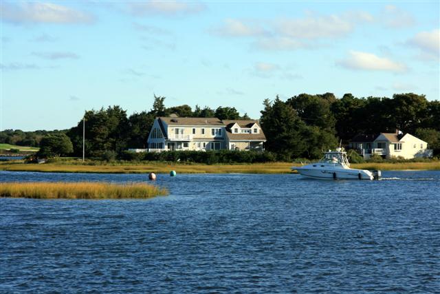
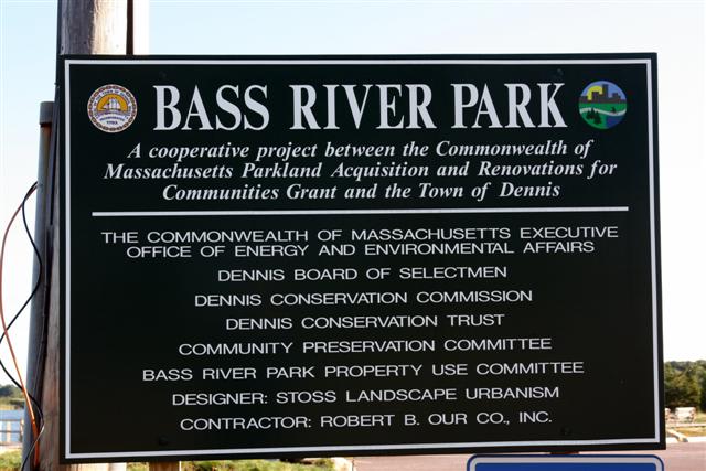
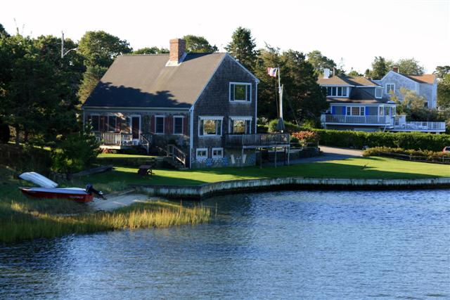
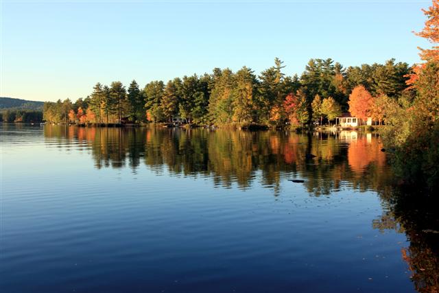
We took Hwy 24 South and arrived at town of Dennis where we found a nice lagoon with homes around it. The sign on the bank of the lagoon indicated that we arrived at Bass River Park. The weather was perfect. The sun was warm and the cool breeze from the lake made it crispy and clear.


We headed back north and stopped at a pancake restaurant for a hot and hearty breakfast. We then returned to the hotel at 9:30 and were told by the attendant that “Check-in is at 12:00”. After pleading to her that we took the “red eye” from Long Beach, California she agreed that we will check-in early and added: “Only if you promise to take a nap… you look as if you could use some sleep…”
We entered our room and collapsed on the bed for a long sleep.
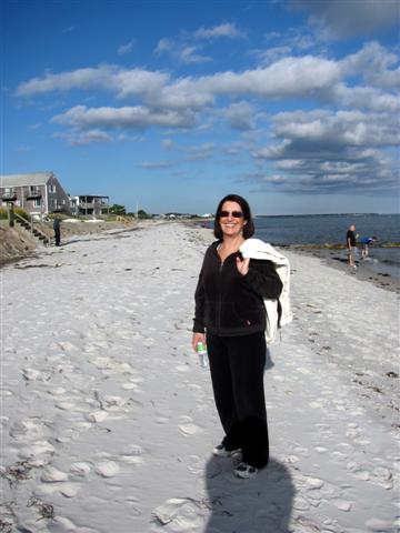
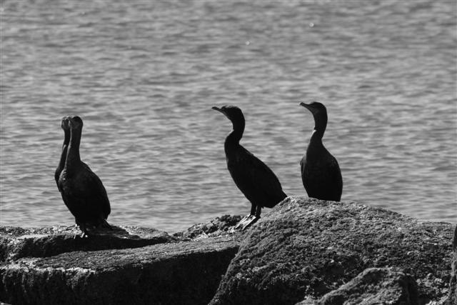
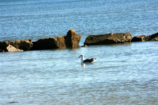
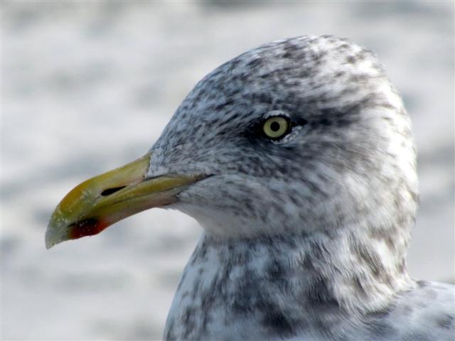
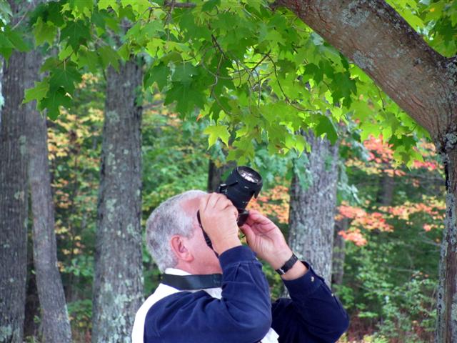
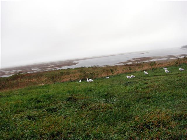
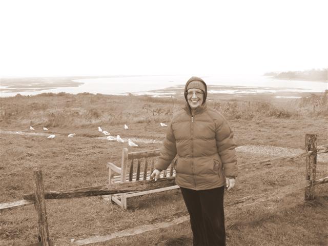
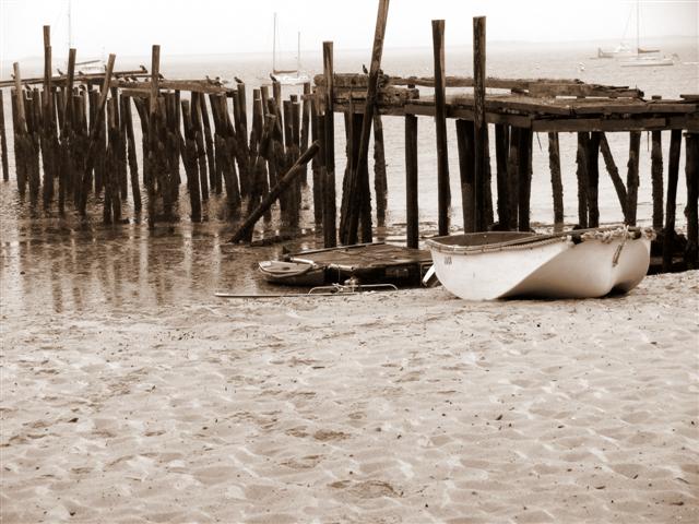
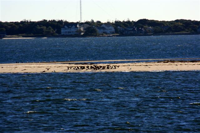
We woke up at 2:30 and walked to the nearby beach (about a mile away). The sea was calm and many birds were diving in for their meal from the salted water. We walked on the beach for about an hour finding along the way some crabs and interesting shells.


We ended up at a local restaurant called The Skipper. The placards on the walls told us that this restaurant is a winner of several awards for their Clams Chowder. We sat on the balcony, overlooking the peaceful ocean and ordered chowder and fish & chips. It was delicious!!
We walked back to our room, unpacked and went to sleep.
=================================================================================================================================================================================
Day 2 - October 3rd, 2010
We woke up at 6:45 and started our drive to White Mountains, New Hampshire.
As we entered The Granite State, We found along interstate 3, a liquor store with about a hundred of cars in its parking lot. We stopped and found out that the cars belong to Massachusetts residents who came to buy alcohol at this place. New Hampshire has long lured Massachusetts residents with low-priced liquor and other bargains. We bought a bottle of wine and continued our journey.

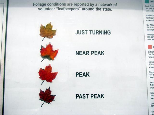
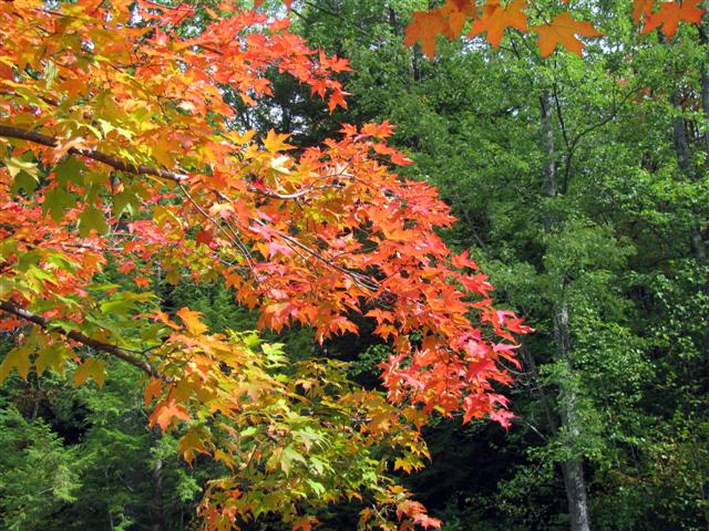
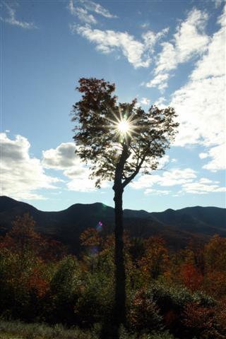
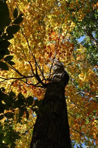
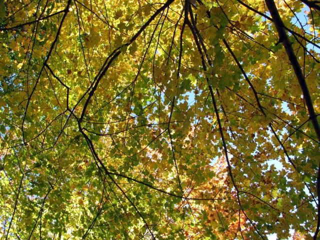
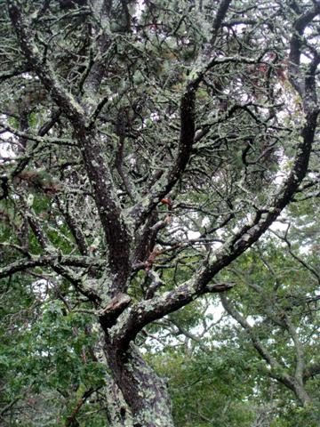
 We stopped at the New Hampshire Welcome Center in Canterbury, to learn more about the “Turning of Leaves” in autumn. We found out that there are four phases of the colors: “Just Turning”, “Near Peak”, “Peak”, and “Past Peak” with their corresponding colors: Yellow, Red, Orange, and Brown. We found some trees at the forest behind the center and the colors were just unbelievable.
=================================================================================================================================================================================


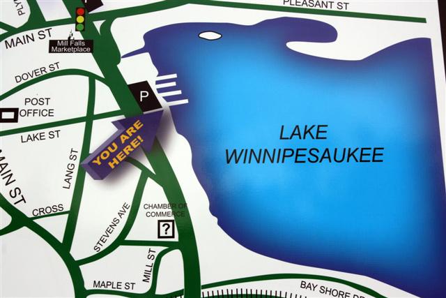
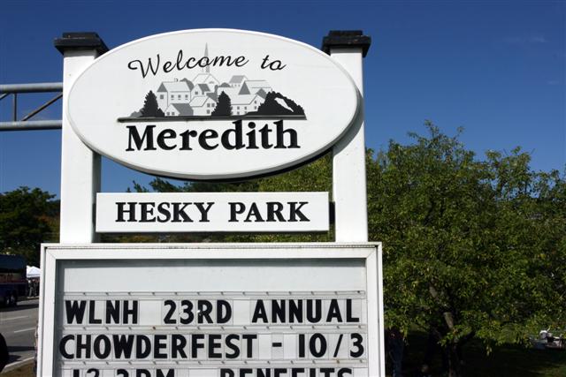
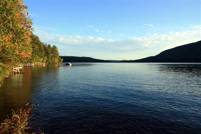
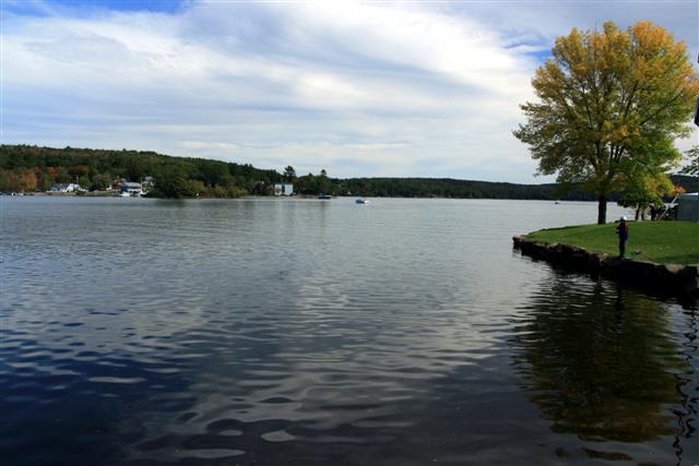 We arrived at Lake Winnipesauke, in central New Hampshire at around 11:00. The weather was just perfect with temperatures in the 70’s and sunny. We walked around the lake for a bit and stopped in Meredith.
 The Meredith Area is truly the heart of the Lakes Region and serves as the key to New England's majestic White Mountains. The city nestled among New Hampshire's largest lakes – and looks like a Swiss village.
=================================================================================================================================================================================
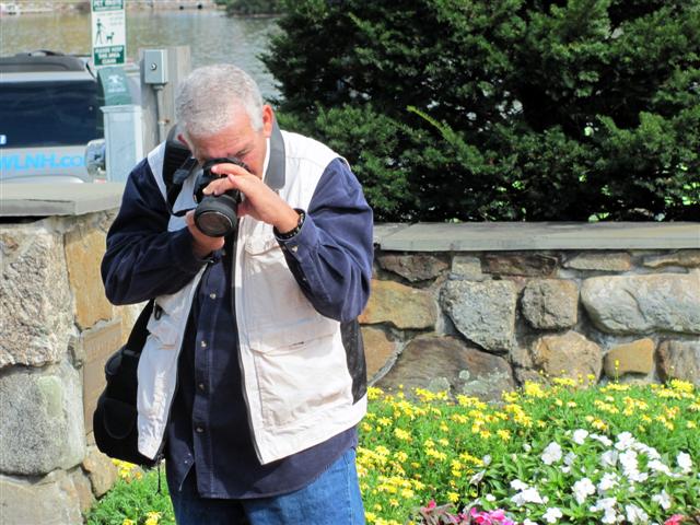


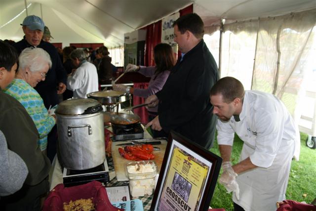
We saw many people gather around a huge tent. It turned out that those people are waiting in line to enter the Chowder Festival that happened to be that day. Since clams chowder is one of our favorite dishes, we decided to wait in line and have lunch there. We had 15(!) different chowders and decided that the lobster chowder was the best.


 We walked to the city’s open market and then went back to our car to continue our journey.
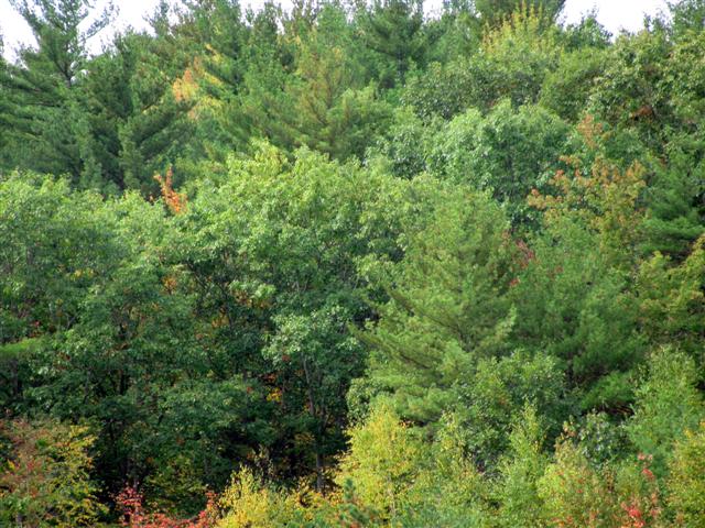
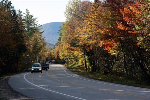
We arrived to the heart of White Mountains at around 2:00 and stopped several times along the way to view the turning of the leaves and the majestic views.
Among others, we saw many beautiful homes, water falls, river banks and beautiful scenery along the way.
We took Hwy 12 East and drove through sleepy towns and villages towards Portland Maine.
=================================================================================================================================================================================
The drive was one of the best I ever did. We passed through the White Mountain National Forest, viewing many beautiful sceneries and glorious homes along the way.


 We arrived in Portland at around 7:00 pm and decided to have dinner. We found Portland Lobster Company restaurant and order a combination of seafood. It was delicious and very reasonable. We sat in a tent by the bay consuming our dinner to the sound of seagulls and other sea birds.
=================================================================================================================================================================================
After dinner we headed back to Cape Cod and arrived there at around 11:30.
We were exhausted but extremely excited of our wonderful day.
=================================================================================================================================================================================
Day 3 - October 4th, 2010
We woke up at 9:30(!) to the sound of rain outside our room. We had breakfast at a local restaurant named Anne & Fran Kitchen.


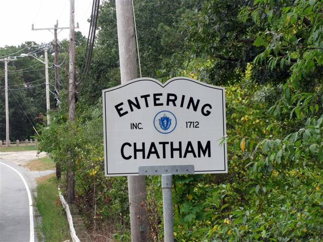
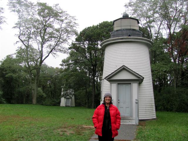
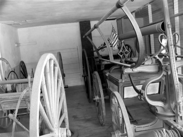
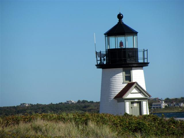
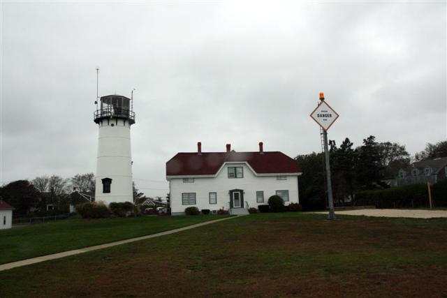 Our first stop at Chatham Lighthouse, The station was established in 1808, the second light on Cape Cod.
Chatham, with sixty-six miles of shoreline, is the only Cape Cod town surrounded on three sides by water – to the north is Pleasant Bay, to the south is Nantucket Sound, while to the east is the open Atlantic Ocean. If the Cape were a bent arm, Chatham would be the elbow. The beauty of Chatham’s shores hides some of the most dangerous waters in Cape Cod: It is said that half of the known wrecks on the entire Atlantic and Gulf of Mexico coasts have occurred off the Outer Beach of Cape Cod.
=================================================================================================================================================================================

 Some history: On April 21, 1806, Congress budgeted $5,000 for a light station at Chatham Light and added an additional $2,000 two years later. To avoid confusion with Highland Light, built nine years earlier near the northern tip of the Cape, two light towers were used at
  Chatham. The contractor, obviously not from the Cape, planned to fabricate the lights on the twelve acres acquired on James’ Head using local stone, only to learn that there is a lack of stone on the Cape. His attempt to import stones came to a halt: “There are no stones to be had so the Lights will have to be made of wood.”
The two octagonal, wooden towers, about 40-feet tall, were placed seventy feet apart atop movable wooden skids (which were later used once to move the towers). Also constructed was a single story, 1-bedroom keeper’s home. The lights, which were suspended on chains, used lard as fuel.
=================================================================================================================================================================================
We drove alongside the shores and were captivated by the beauty of the town.


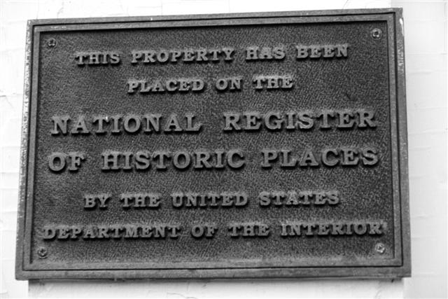
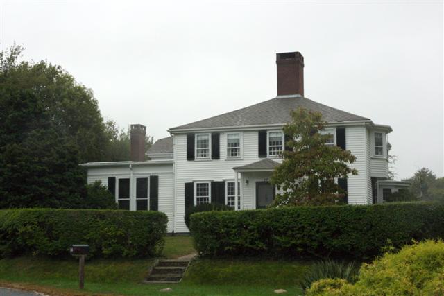
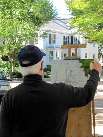
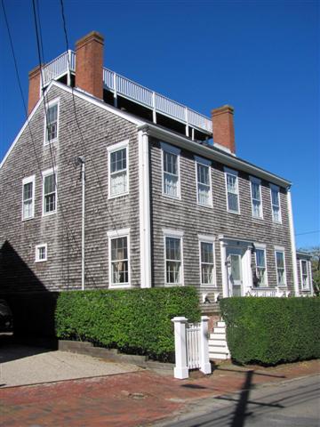
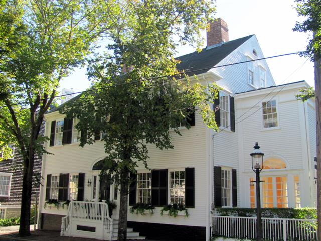
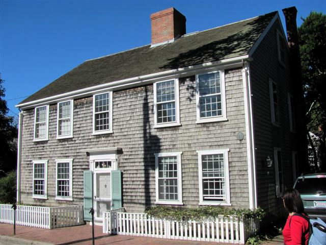
We then took Highway 6-A, Old King’s Highway, the longest national historic road in Massachusetts, and arrived at Captain’s Mile, a strip of famous homes. This section is designated as one of the 10 most scenic drives in America.


Along that section there are some 200 sea captains’ homes that date back to the 1800’s - the heyday of the whaling era on Cape Cod. The brochure we had recommended to view 47 of them.


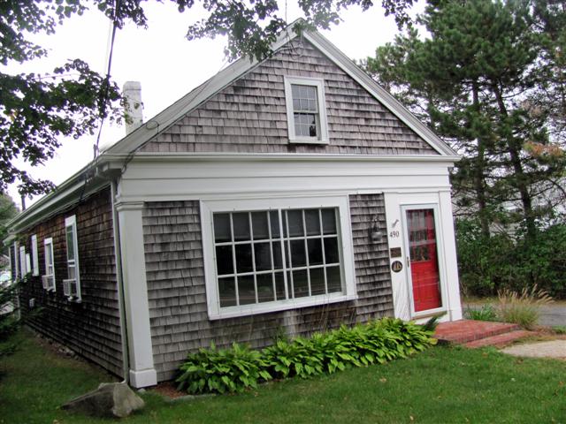


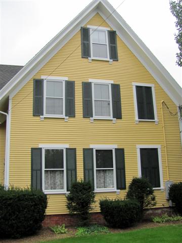
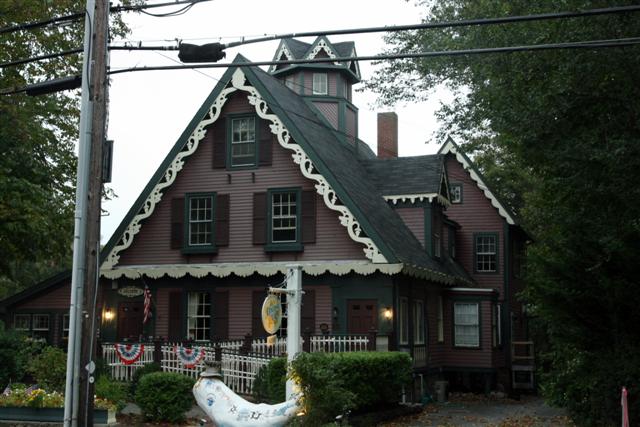
We parked the car and though rain was dropping on us, we somehow managed to go from house to house and accompanied with a map found out the details of many of the famous houses. We were winding along the sinewy tree-lined curves past manicured lawns and well-tended gardens; we spotted the Schooner Plaque homes and imagined what life was like for the hearty sailors that took to the sea in pursuit of whales or some other treasure, and the wives and children they left behind.


We were back at our room around 5:00 and after a short rest we headed to Starbucks at Mashpee’s Columns.
Tomorrow’s forecast: Heavy Rain!!
=================================================================================================================================================================================
Day 4 - October 5th, 2010
When we woke up, at around 8:30, the sky was covered with dark clouds. Not very exciting…We had coffee at our hotel’s room and then took Highway 6 East-North to visit the famous Cape Code’s lighthouses.

 We drove through Orleans, and arrived to Eastham, a coastal resort and quiet community with several Ocean and Bay Beaches, a host of kettle ponds, pretty country lanes, panoramic views of both Cape Cod Bay and the Atlantic Ocean. The town was originally home to the Nauset Indians. In 1651, it was incorporated by a group of Pilgrims who settled here.
=================================================================================================================================================================================
We stopped at Fort Hill and viewed the sweeping ocean views. The gusty wind and the gray skied made it even more dramatic as we walked along the shores.


We then drove to the Three Sisters Lighthouses site, where we learned the following:


 In 1837, a lighthouse station was established at Nauset Beach - halfway between the single light at Highland, and the twins at Chatham, which we saw yesterday. To distinguish the Nauset Station, a keeper's house and three small towers of brick were constructed 150 feet apart. This site marked the only station in the U.S. designated by three towers. In 1911, due to the encroaching sea, the central tower was moved back near the keeper's house. The north and south towers were discontinued, due to maintenance costs and the questionable need for three lights instead of a single light with a unique flashing signature. In 1983, the three towers were moved to a site near Nauset Beach about a quarter mile from their original location.
=================================================================================================================================================================================
 A quarter of a mile down the road is the Nauset Lighthouse, which replaced the Three Sisters Lighthouses in 1923 and was rescued from the edge of a sixty-foot high eroding cliff in November 1996. The tower was moved to a new location approximately 300 feet west and has been providing guidance to mariners traveling along the treacherous coastline of the Cod. It is hoped that in its new location, it will be safe for anot
 her 75-100 years.
We continued our drive and arrived at the town of Wellfleet, which offers loads of appealing rural seaside character and charm and spectacular natural resources.
=================================================================================================================================================================================


We found a great restaurant named (very appropriately to our trip’s subject for the day) The Lighthouse, a home to visitors and locals alike. We enjoyed the famous Blueberry Pancakes along with a hearty breakfast.
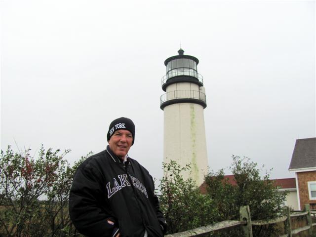
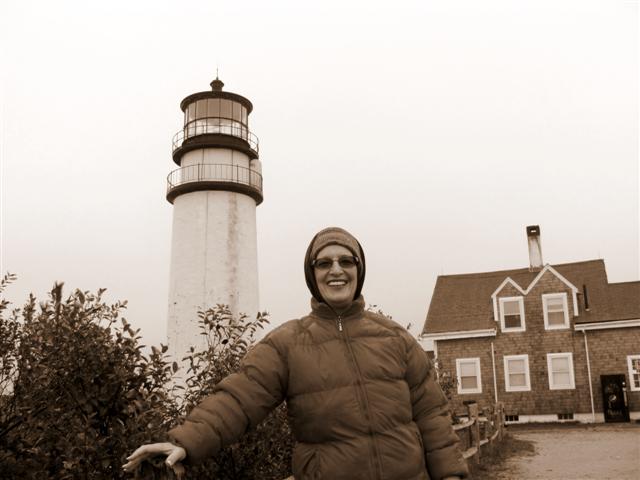
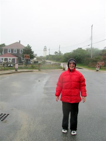
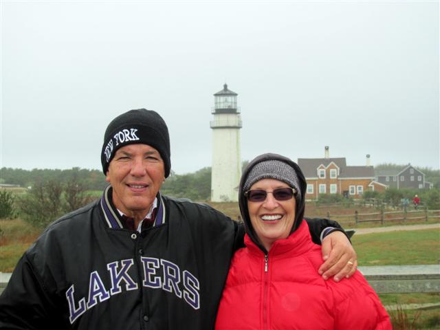
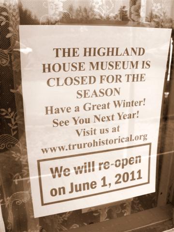
 With our stomach full, we continued our day and arrived at Highland Lighthouse, in North Truro, the second most northerly town on Cape Cod, which was first settled as Pamet in 1646 and was changed to its name today in 1709. In its early years, mariners knew Pamet as Dangerfield because of the frequent wrecks off its shores. A Lighthouse went into service on November 15, 1797. A one-story dwelling for the keeper was also constructed, along with a barn, an oil storage shed, and a well. The total cost of the buildings was $7,257.56(!).
=================================================================================================================================================================================
Storms often hit Highland Light with a vengeance. In the 19th century keepers often had to stay in the lantern room all night to keep the glass clear. Other problems plagued the keepers in summer, such as swarms of moths and birds flying straight into the lantern glass.

A Naval radio station was located at Highland Light in 1904. The station assumed great importance during World War I and was guarded by a detachment of Marines.
When the first lighthouse was built in 1797, it was over 500 feet from the edge of the 125 foot cliff. The cliff continued to erode at a rate of at least three feet a year until, by the early 1990s, the present lighthouse stood just over a hundred feet from the edge. In 1990 alone 40 feet were lost just north of the lighthouse.
In 1996, funds combined with $1 million in federal funds and $500,000 in state funds to pay for the move of the 404-ton lighthouse to a site 450 feet back from its former location. On Sunday, November 3, 1996 Highland Light was re-lighted in its new location.


=================================================================================================================================================================================
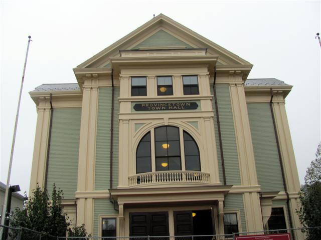
 We continued our trip and used Highway 6A on our way to the historical Provincetown, located at the extreme tip of Cape Cod. The area was originally settled by the Nauset tribe, who had a settlement known as Meeshawn. The town was incorporated by English settlers in 1727 after harboring ships for more than a century. The Pilgrims signed the Mayflower Compact when they arrived at the harbor. They agreed to settle and build a self-governing community, and then came ashore in the West End. Though the Pilgrims chose to settle across the bay in Plymouth, Provincetown enjoyed an early reputation for its fishing grounds.
=================================================================================================================================================================================
 Following the American Revolution, however, Provincetown grew rapidly as fishing and whaling center. The population was bolstered by a number of Portuguese sailors who were hired to work on US ships and came to live in Provincetown. By the 1890s, Provincetown was booming, and began to develop a resident population of writers and artists, as well as a summer tourist industry.
========================================================================================================================================================
 In the mid-1960s, Provincetown saw population growth. The town's rural character appealed to the hippies of the era; furthermore, property was relatively cheap and rents were correspondingly low, especially during the winter. Many of those who came stayed and raised families. Commercial Street gained numerous cafes, leather shops, clothing stores and many others. In the mid-1970s members of the gay community began moving to Provincetown, which prompted gay tourism. Today the town is perhaps the best-known gay summer resort on the East Coast!
=================================================================================================================================================================================


 W
W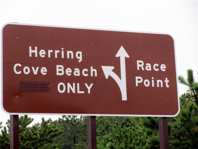 e walked and toured the beautiful streets and window shopped for awhile and then continued to Race Point Beach, named for the fierce rip tides that come around the point of the Cape.
=================================================================================================================================================================================
It was already 5:00 and we decided to drive back. We arrived to Mashpee, and after a delicious Latte at Starbucks we entered the local Movie Theater to watch the “Social Network”, a movie about the creator of Facebook.
We returned to our room at around 11:00
=================================================================================================================================================================================
Day 5 - October 6th, 2010
We woke up to the sound of heavy rain.
Since we had decided that today we will spend locally it did not really affect us that much.
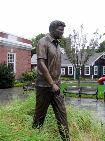
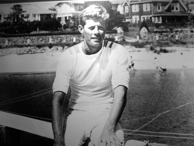
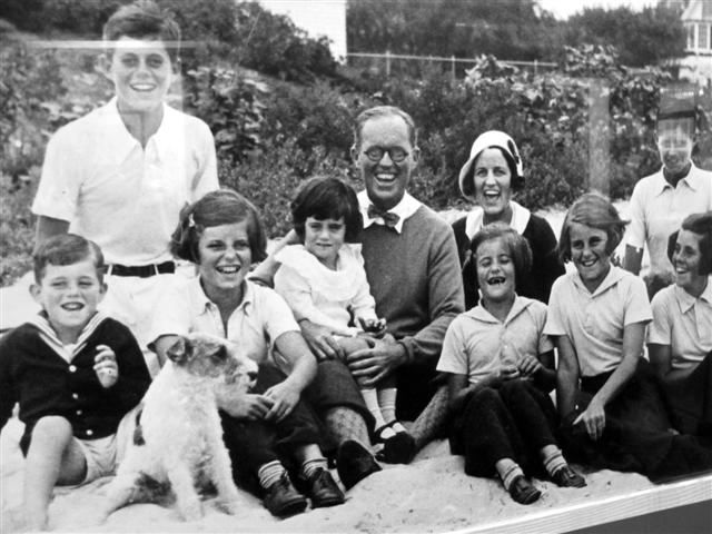
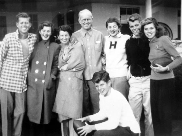
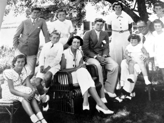
 We found the JFK Museum at the Kennedys hometown of Hyannis on Main Street.
=================================================================================================================================================================================
The museum has a multimedia exhibit designed to open a window on the days JFK spent on Cape Cod; days relaxing with family, days playing football with Navy buddies, days spent sailing on the ocean to which he was so constantly drawn to.


The exhibit features over 80 photographs spanning the years 1934 to 1963 and is arranged in thematic groupings to reflect John F. Kennedy, his family, his friends and the Cape Cod he so dearly loved. In addition to photography, a video narrated by Walter Cronkite depicts the president’s experiences on the Cape. A memorial to John F. Kennedy, Jr., who died in a plane crash in 1999, was recently added.
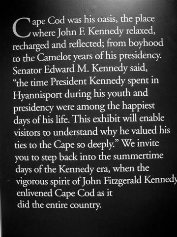

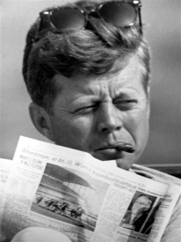

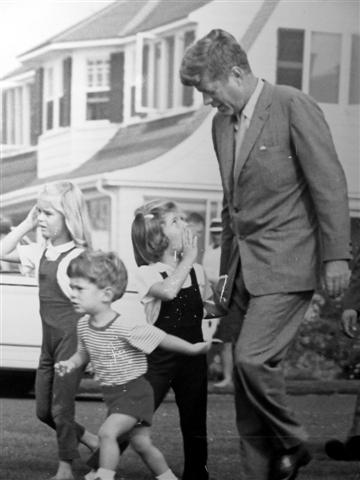

We spend a couple of hours, looking at the black & white photos, viewed few videos and read some articles, learning more about the tragedies that the Kennedys have experienced through their lives In one of the pictures JFK is shown relaxing at the place he called "the one place I can think and be alone."
 The basement floor of the Museum features the Cape Code Baseball Hall of Fame, which honors the past accomplishments of the many standout players, coaches and those who have extended enthusiastic support throughout the years for baseball in Cape Cod.
The league is also notable for its continuing use of wooden bats. Because it draws top-tier college players, the level of play is often considered the equivalent of high-A Minor League Baseball.
Tova sat down while I viewed the exhibits. I learned that many Major League Baseball players have started there during their college years, including Darin Erstad, Terry Steinbach, and Nomar Garciaparra.
=================================================================================================================================================================================


We left the pretty and interesting museum and headed to our favorite Starbucks in Mashpee. Tova tried to get into Res.Net to participate in a seminar online but as it turned out, the seminar was re-scheduled for tomorrow.
We decided to go to the mall and spent the next couple of hours windows shopping and having lunch at TGIF, which was terrible. We then decided to return to Mashpee to watch the “Wall Street -2” movie, which was terrible as well.
We returned to our room ad spent the next hour at the Jacuzzi.
=================================================================================================================================================================================
Day 6 - October 7th, 2010
When we woke up we were happy to see that the rain has gone and only partly cloudy skies were left hanging above us.

 We drove to Boston and arrived at Roxbury, a neighborhood of Boston, at around 11:00. The seminar with Res.Net was scheduled at 12:00, so we found a Starbucks; right across from Harvard Medical School and Tova situated herself at a table right next to a power outlet. We sipped our coffees and then while Tova was connected to Res.net, I left to walk around the neighborhood.
=================================================================================================================================================================================
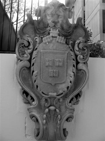
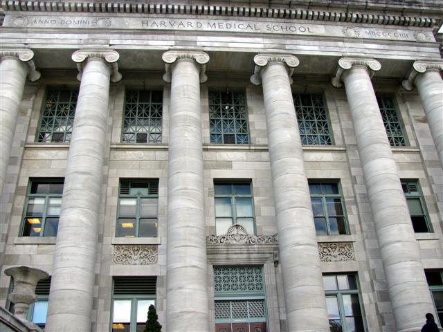 I toured the Medical School, which is one of the graduate schools of Harvard University. It is currently ranked first among American research medical schools by U.S. News and World Report.
=================================================================================================================================================================================


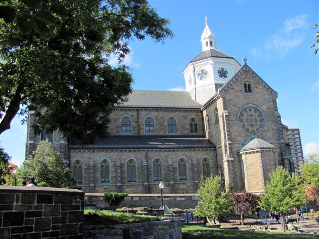
 Sunshine broke through the clouds as I walked up to Tremont Street and in front of me was Mission Church, also known as The Basilica and Shrine of Our Lady of Perpetual Help. The current church structure was first built in 1878 and its spires were added in 1910.
 The church is considered the symbol of the Mission Hills neighborhood. Senator Edward Kennedy's funeral took place there on August 29, 2009. He had often prayed at the church due to its proximity to the hospitals in the Longwood Medical Area of Boston, where he had visited sick and injured members of his family.
=================================================================================================================================================================================


 I returned to Starbucks around 2:00, just when Tova was about done with the online seminar.
 We decided to walk to Harvard Street, about a 2 mile in distance to find Rami’s Restaurant. We know Rami from Vegas and he always talked about his restaurant in Boston. We decided that this will be the appropriate time to go and try some of his Israeli dishes.
=================================================================================================================================================================================
We walked through some beautiful homes in Brookline and finally, near Coolidge Corner, we found the place. The restaurant is pretty small and the Middle Eastern dishes were delicious.
We walked back to the car and drove back to Cape Cod.
A couple of hours later we once again enjoyed the hot water of the Jacuzzi at our hotel.
=================================================================================================================================================================================
Day 7 - October 8th, 2010
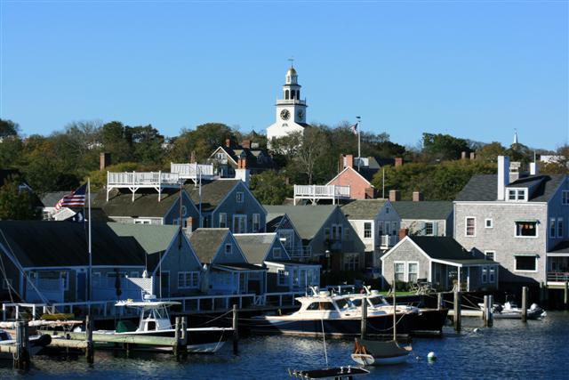
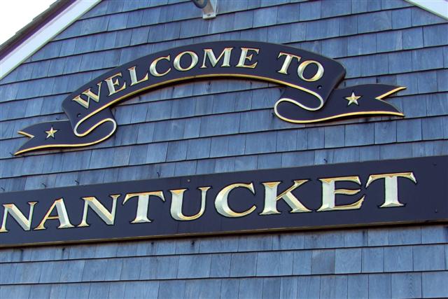
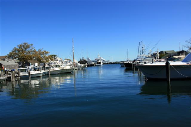
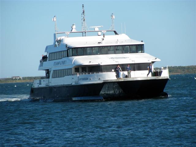
 We woke up at 6:30 and hurried to Hyannis Port to catch the first ferry to Nantucket Island.
Nantucket is a tourist destination and summer colony. The population of the island soars from approximately 10,000 to 50,000 during the summer months, due to tourists and summer residents.
=================================================================================================================================================================================
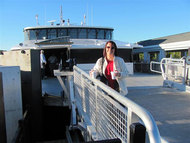


As Columbus Day was just 3 days away, the boat was filled with weekenders, who had planned to stay until Monday night in this magnificent place.
 Nantucket is home to three lighthouses. My main interest of the island was to view two of its three lighthouses. The third one can be visited only by using a 4X4 vehicle.
 The speedy boat arrived to the Nantucket harbor in about an hour and upon our arrival we could view the most popular lighthouse: Brant Point.
=================================================================================================================================================================================

 We decided to postponed our visit to the lighthouse and do first The Historical Walking Tour, which consists of visiting the homes, which were built hundreds of years ago and maintained by the Nantucket Historical Association, Among the highlights were First Congregational Church, Greater Light Home (built in the 18th century) and Hadwen House (built in 1846).
=================================================================================================================================================================================
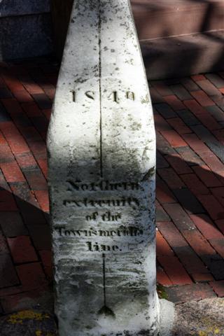


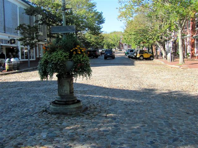


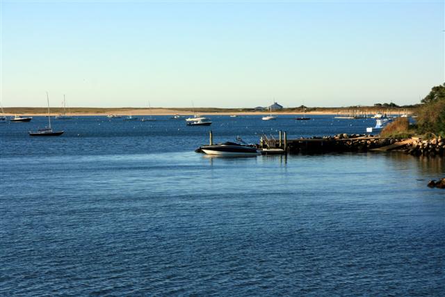
 We walked for about an hour an a half, admiring the beautiful preserved homes, most painted in white. We ended the tour on the
  marina off Main Street, where many locals and tourists walked peacefully on the pier, enjoying the warm sunshine, watching the seagulls diving into the water in search for food.
=================================================================================================================================================================================
We then asked at the Visitors Center on Federal Street about Sankaty Head Lighthouse and were told that we should take the bus and that it will take us about a mile away from the lighthouse, where we will walk the rest of the way to the lighthouse.
 We found the bus and rode to our destination.
 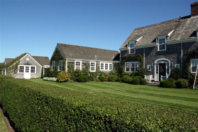 The bus driver told us that he picks up passengers at Siasconset every hour on the 45 mark. The time was around 11:15 and we figured that the 30 minutes ride plus the walk of 2 miles (back and forth) will be sufficient enough to catch the 1:45 bus and catch the ferry at 3:00 pm.
=================================================================================================================================================================================
We started our walk quite slowly, as we figured that we have all the time in the world to make it back and forth. On the way we passed many beautiful and lavish homes. At one point we stopped a jogger to ask him how far the lighthouse is. To our dismay he told us that we still have about 1.5 miles to go. As it turned out, the distance from the bus stop (Off Broadway and Milestone) to the lighthouse was actually about 2 miles. This is when we realized that if we don’t hurry up, we might view the lighthouse, but we will never make it back to the bus on time.

 Tova opted to wait for me, while I started to walk pretty fast towards my destination. I finally saw it: The wonderful Sankaty Head Lighthouse, which was built in 1850 and is still in operation. I also learned that in October of 2007, the lighthouse was moved away from an eroding bluff to its current location. (This fact started to become familiar to me as most lighthouses in Cape Code have the same story behind them).
=================================================================================================================================================================================
Tova called me on my cell. The time was 2:00 and she told me that she is heading back towards the bus station and that I should hurry up if we want to catch it.
I started to run and when I arrived at the bus station the time was 2:46. I saw Tova’s hands waving in motion, as if to tell me “you better speed up, buddy”. As I arrived and entered the bus, the driver closed the doors and told me to thank my wife, who was holding him for the last 3 minutes, promising him that “he is just around the corner”.
 As soon as we returned to the dock’s area we walked about half a mile and arrived at Brant Point Lighthouse, which is America's second oldest light station, built in (1716, (after Boston Light It ) and burned a couple of times (1757 and 1783) and also was destroyed in a storm in March 1774.
 Next to the lighthouse we found the magnificent Coastal Guards station.
=================================================================================================================================================================================
 It was time to return to the ferry. We marched up the street and arrived 15 minutes later to see the ferry arriving from Hyannis full with weekenders and locals with all their luggage, pets, and handbags looking forward to spend the long weekend in this wonderful and peaceful place.
=================================================================================================================================================================================


 We were back to Hyannis an hour later and drove our car to the Lobster Boat Restaurant on Highway 28 (right next to our hotel), which has been serving affordable family meals to locals and visitors for over 30 years. The unique casual waterfront seafood experience allowed us to enjoy the scenic Parkers River overlooking the Marina, while eating excellent seafood and sipping good wine. We ordered clams chowder followed by a wonderful lobster dish plus a fresh tasty fish with salad and baked potatoes as our side dishes. It was delicious!!
We returned to our room and after packing our belonging we hit the sack as tomorrow we will have an early flight to JFK.
=================================================================================================================================================================================
Day 8 - October 9th, 2010
 We woke up at 2:30 am (!) and arrived at Logan International at 4:30 just in time to catch our flight. We arrived to New York City – JFK and after storing our luggage in the airport we caught the subway, which
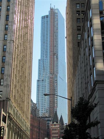
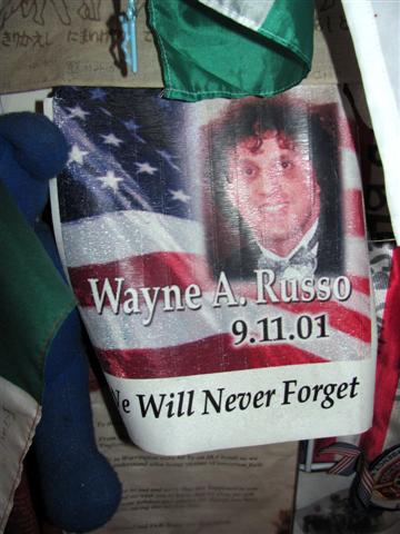
 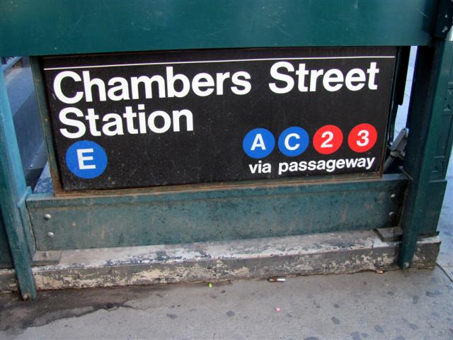 took us to Lower Manhattan. We disembarked at Chambers St. and after a delicious bagel and cream cheese accompanied by a Grande Skinny Vanilla Latte we walked a short 2 blocks to arrive at Ground Zero.
 We learned that The Freedom Tower is estimated to complete at the end of 2013. (it was originally thought to complete at the end of 2011). This new construction will become the world’s tallest building when completed. It will beat the WTC’s height by over 30m, with its total height of 1,776 feet, which is symbolic of the year the United States Declaration of Independence was signed. Three other high-rise office buildings are planned for the site along Greenwich Street, and they will surround the World Trade Center Memorial. The area will also be home to a museum dedicated to the history of the site.
=================================================================================================================================================================================


 After viewing the construction that is going on we walked toward Park Street to view the (now) famous location where a mosque is planned to be built there in the near future. Originally named Cordoba House, is a planned 13-story Muslim community center to be located two blocks from the World Trade Center site. The majority of the center will be open to the general public. It will contain a Muslim prayer space that has controversially been referred to as the "Ground Zero Mosque". It would replace an existing 1850s Italianate-style building that was being used as a Burlington Coat Factory before it was damaged in the September 11, 2001 attacks.
=================================================================================================================================================================================
 Two NYC patrol cars were parked next to the building and a couple of police o
 fficers were sipping their coffee and biting on (what else) doughnuts. A security camera was visible on top of a pole. We met a person across the street taking a cigarette break from his job. He told us that he was there, in the building across the street, on September 11th and described to us that moment when he felt the earth moving and the building shaking and how they all ran to the windows, facing WTC, and saw with disbelief what was going on. He also added his thoughts about the new center and suggested that though the Muslims have right to build anywhere in the city, it would be better of for them and to the entire city if they did it somewhere else, as this location will always attract problems.
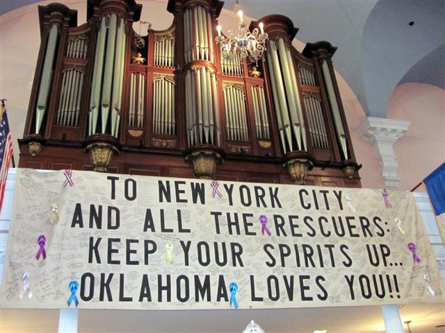
We returned to Ground Zero and entered St. Paul Chapel to view the selected hundreds of letters and other gestures, sent after the tragic event.
=================================================================================================================================================================================


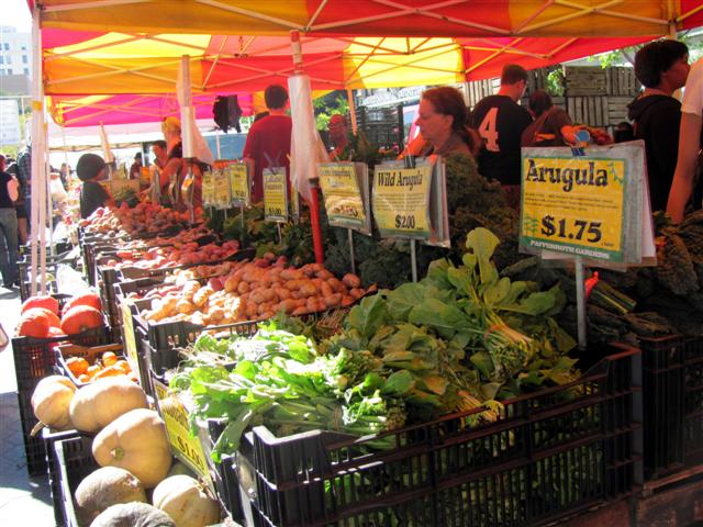
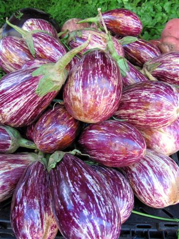
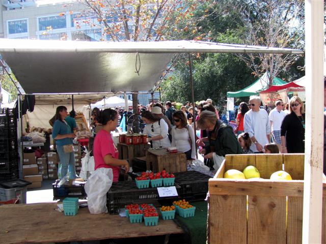
We decided that since we have plenty of time to return to JFK, we should just walk the distance to Upper Manhattan (about 6 miles) and try to get a bite to eat at our favorite deli in the city. We walked up Broadway, did some shopping and even stopped at the Farmers Market.

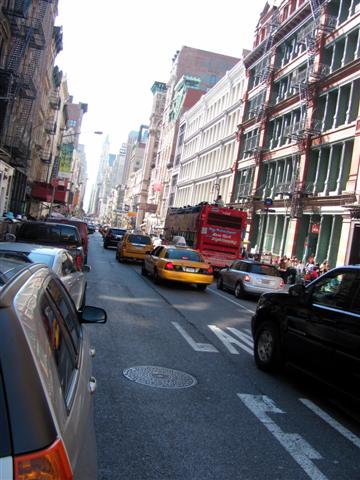


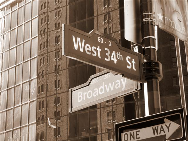
 We noticed right away the changes in the city. Broadway, for example (around 34th street) now has a place to park your car on both sides, sit in an outside café, and enjoy looking at the thousands of people passing by. The city is also much cleaner than what we saw during our past visits.
=================================================================================================================================================================================


 We arrived at Time Square when Tova spotted Craig Sager, the colorful announcer of TNT and TBS. He is famous for his interesting and often loud dressing style. He was on the air when we spotted him and Tova was not even concerned a bit as she approached him and said: “My husband thinks that you wear funny cloths… I find them very charming”, to which Mr. Sager smiled and posed for a picture.
=================================================================================================================================================================================
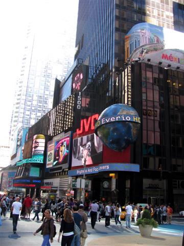
Time Square was so alive, as tens of thousands of people were walking on the intersection of 7th Avenue and Broadway in this bright, warm and sunny day. There were many street performers as well.


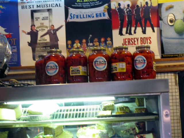
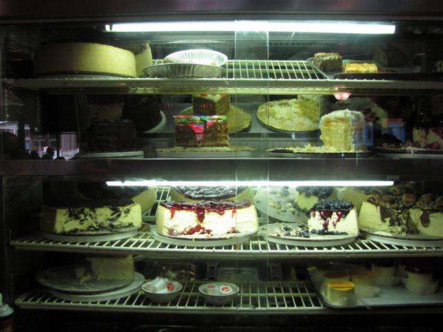
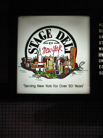 We arrived a short while later to Carnegie Deli on 7th Avenue and 55th Street but when we saw the line of people waiting outside to enter the famous deli, we decided that we should instead walk a couple of short blocks and enter The Stage Deli, which is 2nd best but nevertheless, very tasty, and it was!!!
=================================================================================================================================================================================


After the early dinner we took the subway to Howard Beach and then took the Air Train back to the airport.
We took the 6:00 o’clock flight to LAX and about 7 hours later we were back home.